Cauvery River Source :
The Cauvery river originates at an elevation of 1,341m at Talakaveri on the Brahmagiri range near Cherangala village of Kodagu District ,Karnataka.
Cauvery River Mouth :
The Cauvery rivers ends at Bay Of Bengal at Poompuhar ,in Nagapattanam District in Tamilnadu.
Cauvery River Basins :
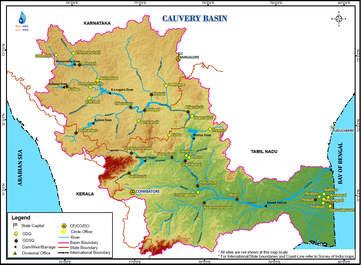
# The total length of Cauvery river is 800km.
# It flows through the states of Karnataka,Tamilnadu,Kerala and Union Territory of Pondicherry.
#It drains total area of 81,155sq.kms.
Karnataka : 34,273sq.kms
Tamilnadu : 43,856sq.kms
Kerala : 2866sq.kms
Union Territory of Pondicherry : 160sq.kms.
# North of Cauvery is Tungabhadra Sub-Basin
#South of Cauvery runs Palar Basin.
#Western Ghats on western Side and Eastern Ghats on Eastern Side.
Source : Water resources information system of India
Tributaries Of Cauvery River:
Right Tributaries
1.Lakshmanatirtha
2.Kabbani
3.Suvarnavati
4.Bhavani
5.Noyil
6.Amaravati
Left Tributaries :
1.Harangi
2.Hemavati
3.Shimsha
4.Arkavati
River Flow Explanation:
# From Brahmagiri range,the river flows into Deccan Plateau and reaches Shivanasamudram in Mandya district of Karnataka.
# At Shivanasamudram,the river branches into two parts and falls through a height of91m in a series of falls and rapids.
# One branch forms Srirangapatna Island and other forms a waterfall called as Shivanasamudra waterfall.
# The two branches join after the fall and flow through a wide gorge Mekadatu(Goats Leap) and continues its flow to form boundary between Karnataka and Tamilnadu.
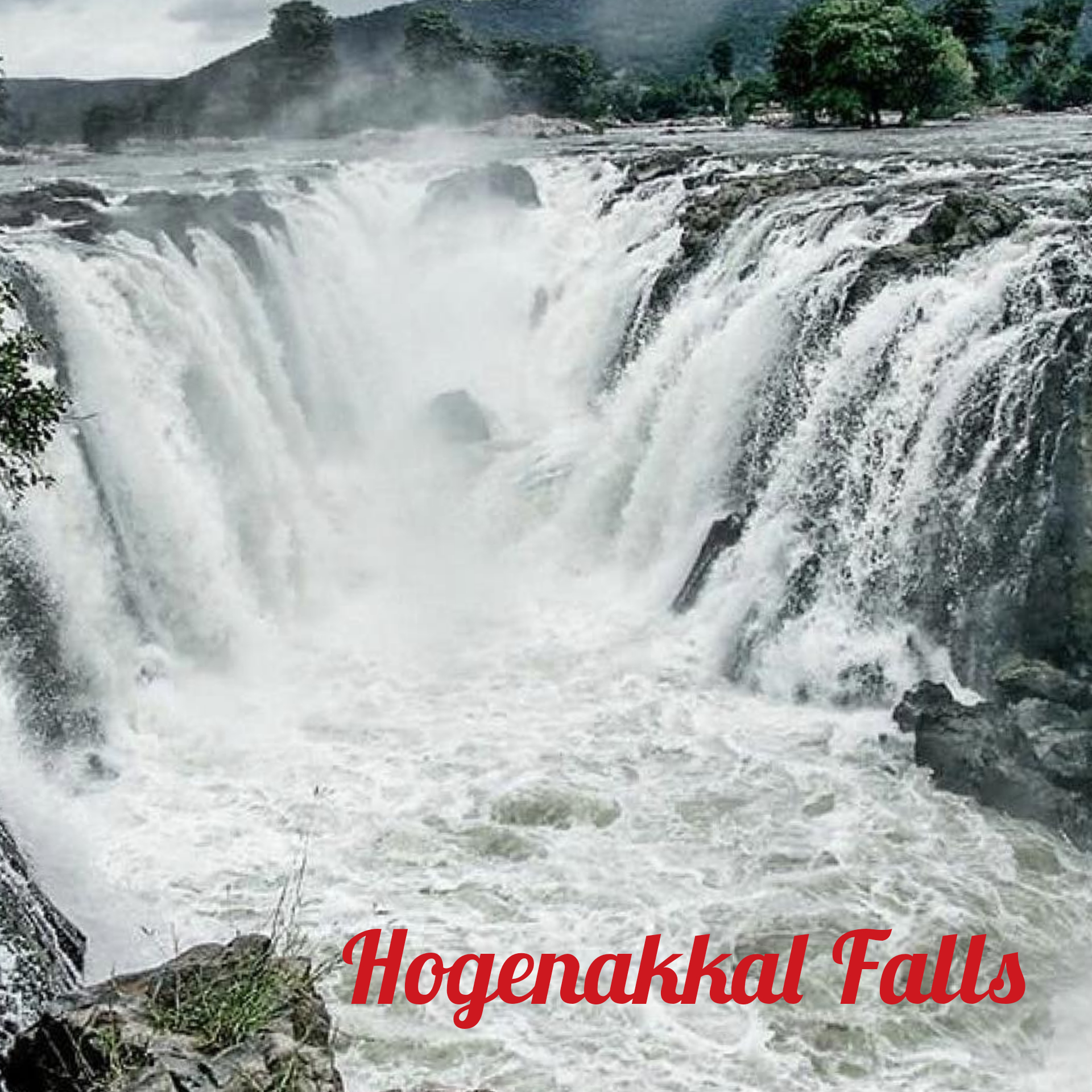
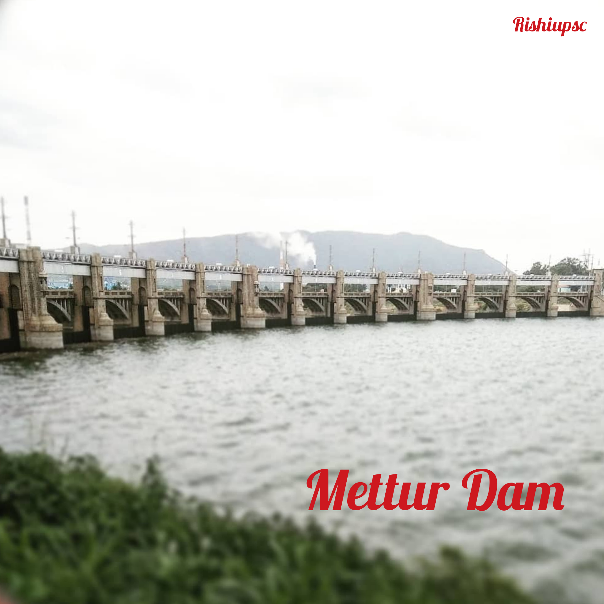
#When Cauvery river reaches Hogennekkal Falls ,it takes southery direction and enters Mettur Reservoir.
# Bhavani joins from right side below Mettur Reservoir.
# Then Cauvery takes easterly direction and enter into the plains of Tamilnadu.
# Now,two more tributaries joins Cauvery named Noyil and Amaravati on right bank and thus River widens and flows as AKHANDA Cauvery.
# After crossing Thrichi District ,the river again divides into southern branch and northern branch.Northern branch names as the COLERON and southern branch remains as cauvery.
# On the cauvery branch lies the Grand Anicut (Go to this link to learn Grand Anicut https://rishiupsc.com/kallanai-dam/.)
# Now cauvery delta begins and two branches join at Srirangam Island.
# The Delta part of cauvery is the most fertile areas of Cauvery basin.


Tributaries Explanation :
Right Tributaries :
1.Lakshmana Tirtha :
# It rises in Kodag District and Flows eastward.
# It then joins Cauvery river in Krishna Raja Sagar Lake.
2.Kabini River :
# It rises in Wayanad District in Kerala by the confluence of two small rivers from Kerala.
# It then joins with Cauvery at Mysore District ,Karnataka.
# Kabini Wildlife Sanctuary,Nagarahole National Park Located on the banks of River Kabini River.
# Kabini dam in built on river Kabini ,through which significant amount of water is discharged into Mettur Reservoir.
3. River Suvarnavati :
# River suvarnavati is also called as Honnuhole ,begins from Nasurghat hills in Mysore.
# Suvarnavati is 88km long.
4.Bhavani River :
# Originates in Nigiri Hills of Western Ghats.
# The river joins Cauvery at Erode District ,Tamilnadu.
# Silent Valley National Park,Mudumalai National park situated on the banks of river Bhavani.
# Bhavani Sagar dam is located on Erode District on Bhavani river.
# Kodiveri Dam is also situated in Erode District on Bhavani River.
5.Noyil River :
# Noyil river rises from vellingiri hills in the Western Ghats in Tamilnadu.
# It Joins with cauvery river in Karur district in Tamilnadu.
#Two dam belong to Noyil river are 1.Orathuppalayam and 2.Aathupalayam ,first one in Tirupur district and the second one in Karur District.
6.Amaravati River :
# It rises from Manjampatti Valley between Annamalai hills and Palni Hills near to Indira Gandhi National Park in Tirupur District.
# It joins with cauvery at Karur District .
# Amaravati dam on Amaravati river is located in Tirupur District.
Left Tributaries:
1.Harangi River :
#It rises from pushpagiri hills at kodag District in Karnataka.
# The length of the river is 50km.It joins with cauvery in Kodag District itself.
# Harangi Reservoir is located on Harangi river on the Mysore -Kodag borders.
2.Hemavati River :
# It rises near Ballala Rayana Durge in the Chikmagalur District.
# It joins with the cauvery river near Krishnarajasagara.
3.Shimsha River:
#shimsha river rises in Devarayanadurga hill in the Tumkur District of Karnataka.
# It joins with the cauvery near Shivanasamudra Falls.
#The total Length of river is 221km.
#Markonahalli Dam is built across the river Shimsha in Tumkur District.
4.Arkavati River :
# Arkavati river originate at Nandi hills in Chikkaballapura District.
# It joins cauvery river near Mekadatu.
#Three dams built on this river are Tippagondanahalli Reservoir ,Hesaraghatta Reservoir and Manchanabele Dam.
Some Of The Dams On Cauvery River:
1.Alalur Dam —.> On river Lakshamanathirtha
2.Chakena Hally Dam —>Hemavathy River.
3.Chikkagondanyhally River —>Arkavathy River
4.Doddaladahalli Dam—>Arkavathy River
5.Haseraghatta Dam —> Arkavathy River
6.Kadaba Dam —>Shimsha River
7.Karimuddenahalli Dam—>LakshamanaThirtha RIver
8.Mallaghatta Dam —> Shimsha River
9.Manchanabele Dam —>Arkavathy River
10.Maralvadi Dam—>Arkavathy River
11.Marconahally Dam —> Shimsha River
12.Nittur Dam —> Shimsha River
13.Obichudanahally Dam —> Arkavathy RIver
14.Pillur Dam—> Bhavani River
15.Sarigehally Dam —> Shimsha River

