
WHAT IS CYCLONE ???
=> Cyclones are atmospheric disturbances, characterised by, a centre of low pressure area surrounded by swift and often distructive air circulation
=>Usually accompanied by violent storms and bad weather
=>The circulates inward in an anticlockwise direction in northern hemisphere and clockwise in southern hemisphere..
TYPES : From the location point of view cyclones are classified as
1.Temperate Cyclone
2.Tropical Cyclone
TEMPERATE CYCLONES
#Region of Formation : 35-65 degree latitude in both hemispere(that is within temperate region)
#Cause of origin : Convergence of two contrasting air masses – warm and cold air masses…..That is the formation of fronts
#After their formation temperate cyclones move in easterly direction under the influence of westerly wind,,,
#Therefore the velocity of temperate cyclones is weaker(35 – 50 kph)
#Thereby controlls the whether conditions in the middle lattitudes
#Area : Temperate cyclones is so large and extensive
#Shape : Circular,semi circular,elliptical,elongated or ‘V’ shaped
MAJOR LOCATIONS OR BREEDING AREAS OF TEMPERATE CYCLONES
1.Originate in the northern pacific -> off north east and eastern coasts of Asia ->move easterly direction towards gulf of Alaska -> moves south ->finally reaches southern california ->move inland and dissipate at the western slopes of Rocky mountains
2.North America
3.Originate in Gulf of Mexico ->northern direction->east of Appalechians->follow course of Guolf stream->merges withicelandic zone of frontogenesis
4.North west north atlantic
5.Area between iceland and barren sea
6.Continental Europe ; baltic sea and meditterranean sea ( this part flows eastward pakistan and then to northern india during winter season and cause precpitation – blessing for rabi cropes in punjab)
TROPICAL CYCLONE
#REGION OF FORMATION : Between Tropic of Capricon and Tropic of Cancer
#ORIGIN : (Tropical cyclone is like a heat engine which is energised by the latent heat of condensation)
#Conditions for the origin of Tropical cyclone
1.condinous supply of warm and moist air (ie, during summer season – 27*C)
2.Higher value of coriolis force (as there is no coriolis force near equater there is the absence of tropical cyclones in the belt of 5-8*widthon either side of equator)….Majority of the cyclones originate within the 5-20 * latitude
3.Associated with Inter Tropical Convergent Zone(ITCZ) – extends from 5-30 * north during summer season
4.Anticyclonic circulation at the height of 9-15 km above the surface disturbance..It sucks air from 0ceanic surface and upward movement of air is accelerated. Low pressure at the centre is further intencified
MAJOR CHARACTERISTICS
1.Size : 80-300 km
2.Varying velocities : 30-180 kmph
3.More vigorous and move with high velocities over oceans but become weak feeble while moving over land and ultimately die
4.Affect only coastal areas of continent (eg: south and south east of USA- Florida,North and South carolina
5.Not uniform and regular
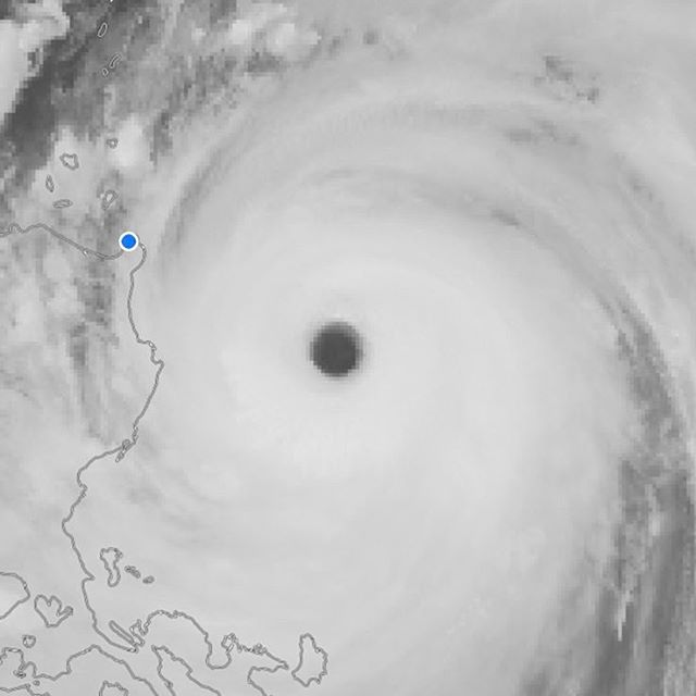
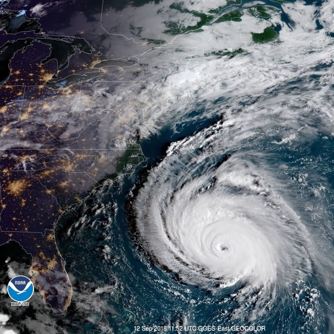
6.Extremely low pressure at the centre…
7.Isobars are circular and few in number
8.Not characterised by temperature difference as they are not formed by frontogenesis
9.No different rainfall cellss in tropical cyclones…hence each part of the cyclone yields rainfall
10.Not always mobile – heavy rainfall at a particular place
11.This cause heavy flood and other deadly disasters
12.Track movement : east to west under the influence of trade winds
13.Confined to particular period of the year – mainley during summer
WEATHER CONDITIONS
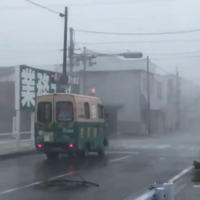
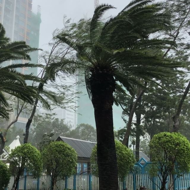
->sudden increase in air temperature and wind velocity
->decrease in air pressure
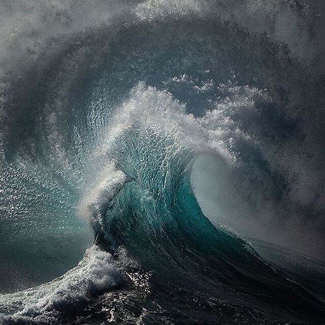
->appearance of cirrus and cirrostratus clouds,,, eventually thickens and become cumulonimbus clouds that yield heavy rain,,,thundering and lightening
->emergence of high waves in the ocean – ie, sea surge
->zereo visibility
DISTRIBUTION
5 to 15 * latitude in both hemisphere and influence weather of coastal areas of the continents
->west indies, gulf of mexio and caribbean sea(atlantic ocean)
->western north pacific ocean – philippines island, china sea and japanese islands
->arabean sea and bay of bengal( north indian ocean)
->mexico and south-central america
->madagaskar islands(south indian ocean)
->samoa and fiji islands and north coast of australia(south pacific)
WORLDWIDE TERMINOLOGY
Cyclones are given many names in different regions of the world – They are known as
^Typhoons in the China Sea and Pacific Ocean;
^Hurricanes in the West Indian islands in the Caribbean Sea and Atlantic Ocean;
^Tornados in the Guinea lands of West Africa and southern USA.;
^Willy-willies in north-western Australia and
^Tropical cyclones in the Indian Ocean
ENVIRONMENTAL IMPACT
Trpical cyclones are severe disastrous natural hazards which inflict heavy loss to human lives and property..
DISASTER MANAGEMENT PERSPECTIVE
The criteria below has been formulated by the Indian Meteorological Department (IMD), which classifies the low pressure systems in the Bay of Bengal and the Arabian Sea on the basis of capacity to damage, which is adopted by the WMO.
| Type of Disturbances | Wind Speed in Km/h | Wind Speed in Knots |
|---|---|---|
| Low Pressure | Less than 31 | Less than 17 |
| Depression | 31-49 | 17-27 |
| Deep Depression | 49-61 | 27-33 |
| Cyclonic Storm | 61-88 | 33-47 |
| Severe Cyclonic Storm | 88-117 | 47-63 |
| Super Cyclone | More than 221 | More than 120 |
1 knot – 1.85 km per hour
Cyclones are classified into five different levels on the basis of wind speed.
They are further divided into the following categories according to their capacity to cause damage:-
| Cyclone Category | Wind Speed in Km/h | Damage Capacity |
|---|---|---|
| 01 | 120-150 | Minimal |
| 02 | 150-180 | Moderate |
| 03 | 180-210 | Extensive |
| 04 | 210-250 | Extreme |
| 05 | 250 and above | Catastrophic |
.
INDIAN CONTEXT
The Indian subcontinent is one of the worst affected regions in the world. The subcontinent with a long coastline of 8041 kilometres is exposed to nearly 10 per cent of the world’s tropical cyclones. Of these, the majority of them have their initial genesis over the Bay of Bengal and strike the East coast of India.
On an average, five to six tropical cyclones form every year, of which two or three could be severe.
More cyclones occur in the Bay of Bengal than the Arabian Sea and the ratio is approximately 4:1.
Cyclones occur frequently on both the coasts (the West coast – Arabian Sea; and the East coast – Bay of Bengal). An analysis of the frequency of cyclones on the East and West coasts of India between 1891 and 1990 shows that nearly 262 cyclones occurred (92 of these severe) in a 50 km wide strip above the East coast. Less severe cyclonic activity has been noticed on the West coast, where 33 cyclones occurred the same period, out of which 19 of were severe.
Tropical cyclones occur in the months of May-June and October-November.
Cyclones of severe intensity and frequency in the North Indian Ocean are bi-modal in character, with their primary peak in November and secondary peak in May.
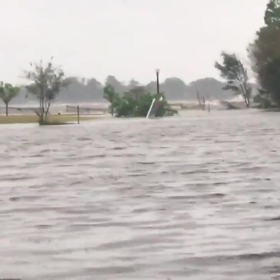
The disaster potential is particularly high during landfall in the North Indian Ocean (Bay of Bengal and the Arabian Sea) due to the accompanying destructive wind, storm surges and torrential rainfall.
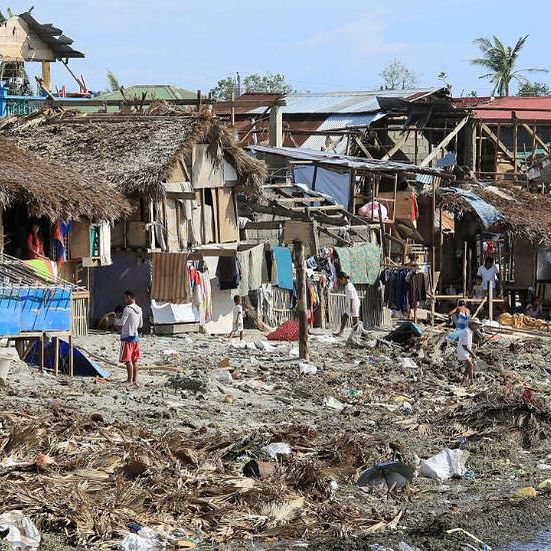
Of these, storm surges cause the most damage as sea water inundates low lying areas of coastal regions and causes heavy floods, erodes beaches and embankments, destroys vegetation and reduces soil fertility.
STORM SURGES
Storm surges (tidal waves) are defined as the rise in sea level above the normally predicted astronomical tide. Major factors include:
- A fall in the atmospheric pressure over the sea surface
- Effect of the wind
- Influence of the sea bed
- A funnelling effect
- The angle and speed at which the storm approaches the coast
- The tides
The very high specific humidity condenses into exceptionally large raindrops and giant cumulus clouds, resulting in high precipitation rates. When a cyclone makes landfall, rain rapidly saturates the catchment areas and the rapid runoff may extensively flood the usual water sources or create new ones
Cyclones vary in diameter from 50 to 320 km but their effects dominate thousands of square kilometers of ocean surface and the lower atmosphere. The perimeter may measure 1,000 km but the powerhouse is located within the 100-km radius. Nearer the Eye, winds may hit at a speed of 320 km. Thus, tropical cyclones, characterized by destructive winds, torrential rainfall and storm surges disrupt normal life with the accompanying phenomena of floods due to the exceptional level of rainfall and storm surge inundation into inland areas.
Cyclones are characterized by their devastating potential to damage structures, viz. houses; lifeline infrastructure-power and communication towers; hospitals; food storage facilities; roads, bridges and culverts; cropss etc.
The most fatalities come from storm surges and the torrential rain flooding the lowland areas of coastal territories.
Environment and Social management Framework – The National Cyclone Risk Management Project (NCRMP)
‘NCRMP’ is a pioneer project drawn up with the purpose of creating suitable infrastructure to
mitigate the effects of cyclones in the coastal states of India in a sustainable way.
The project has identified 13 cyclone prone States and Union Territories (‘UTs’), with varying levels of vulnerability. These States/UTs have further been classified into two categories; based on the frequency of occurrence of cyclones, size of population and the existing institutional mechanism for disaster management.
These categories are:
Category I: Higher vulnerability States i.e. Andhra Pradesh, Gujarat, Orissa, Tamil Nadu and West
Bengal.
Category II: Lower vulnerability States i.e. Maharashtra, Goa, Karnataka, Kerala, Daman & Diu,
Pondicherry, Lakshadweep and Andaman & Nicobar Islands.
The key objectives of the project are:
Reduction in vulnerability of coastal states through creation of appropriate infrastructure which can help mitigate the adverse impacts of cyclones, while preserving the ecological balance of a coastal region.
Strengthening of cyclone warning systems enabling quick and effective dissemination of warning and advisories from source/district/sub-district level to the relevant communities